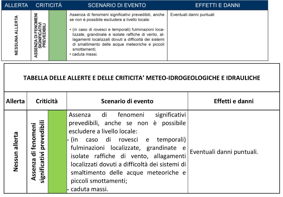
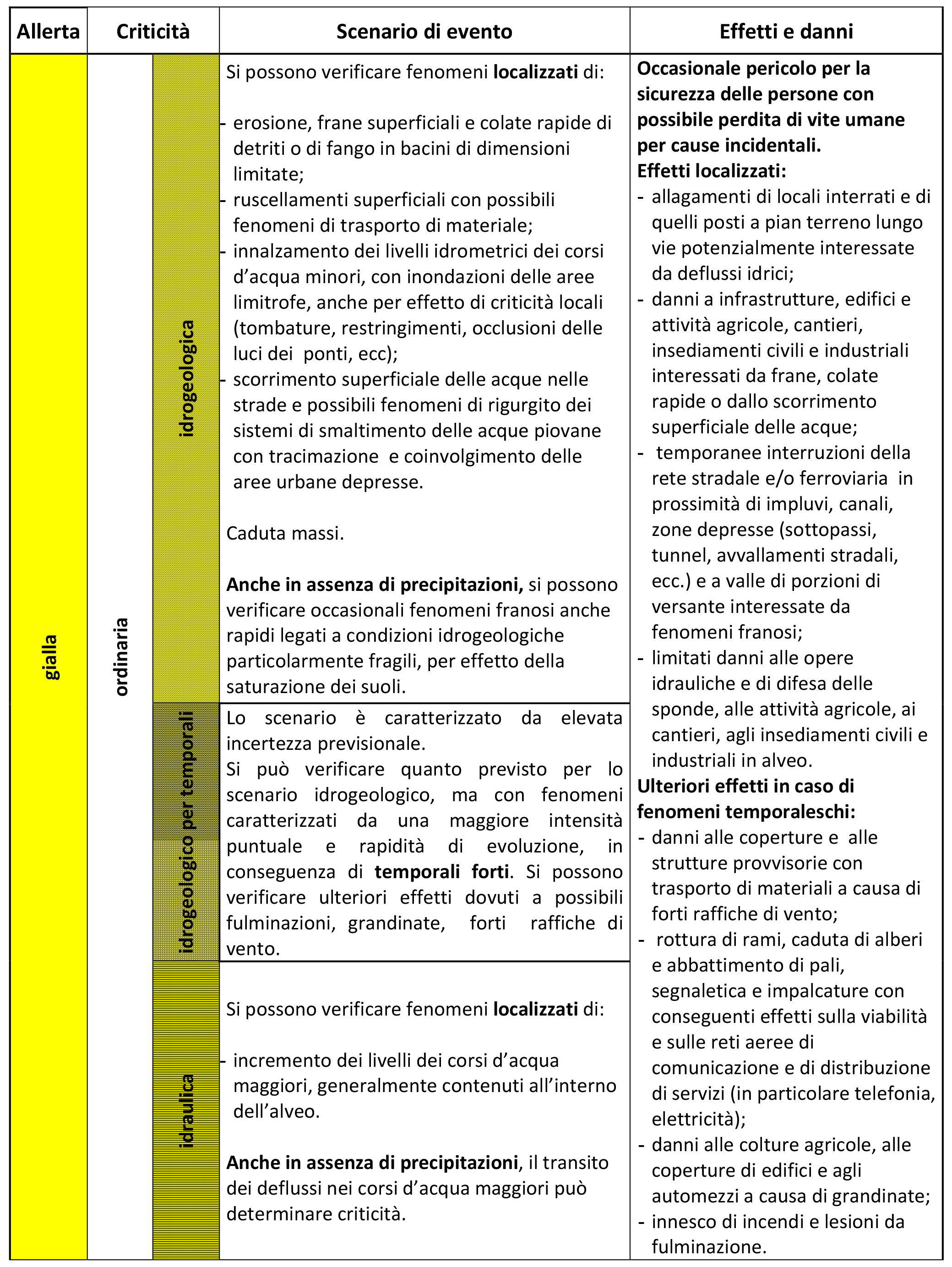
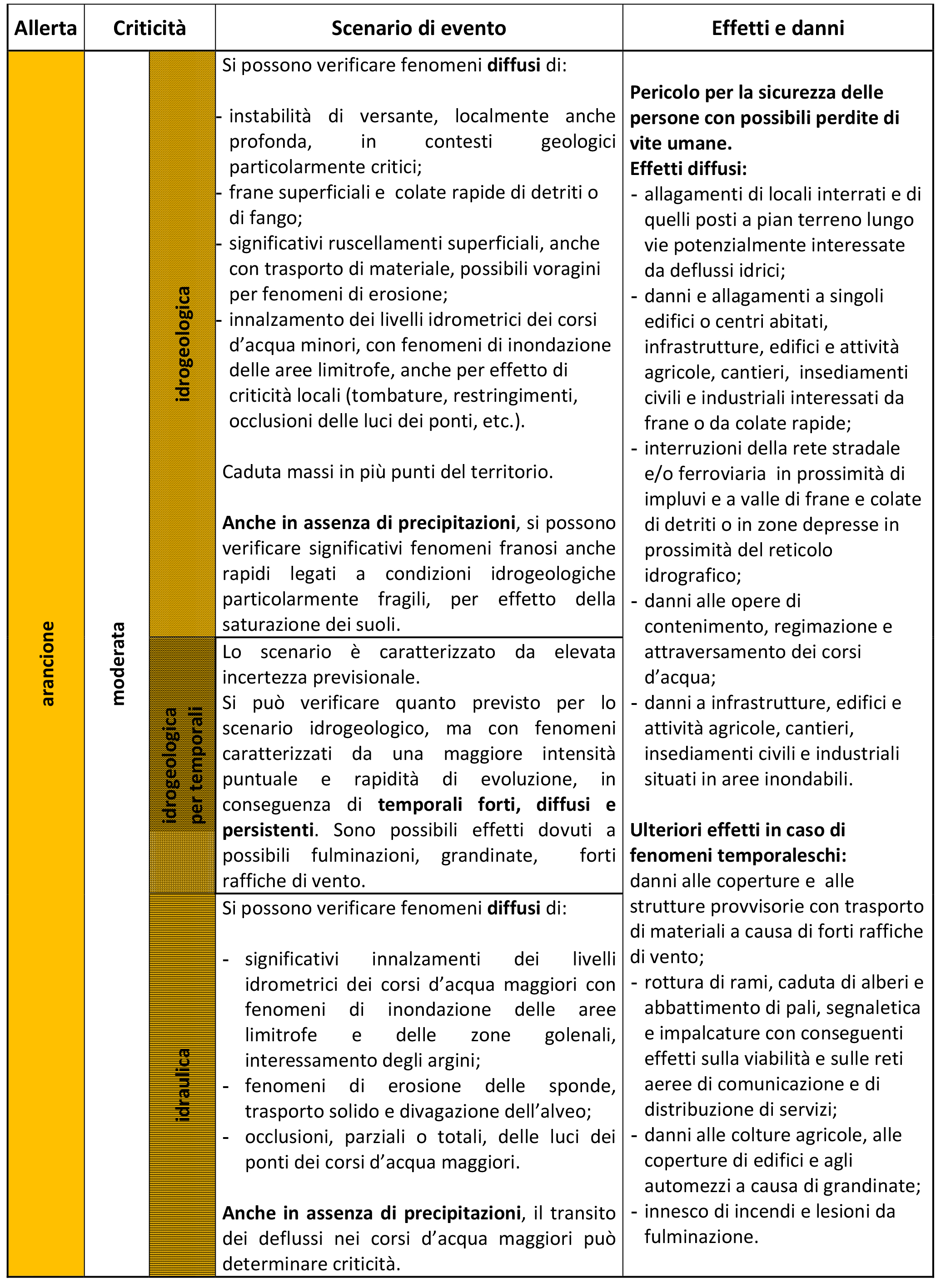
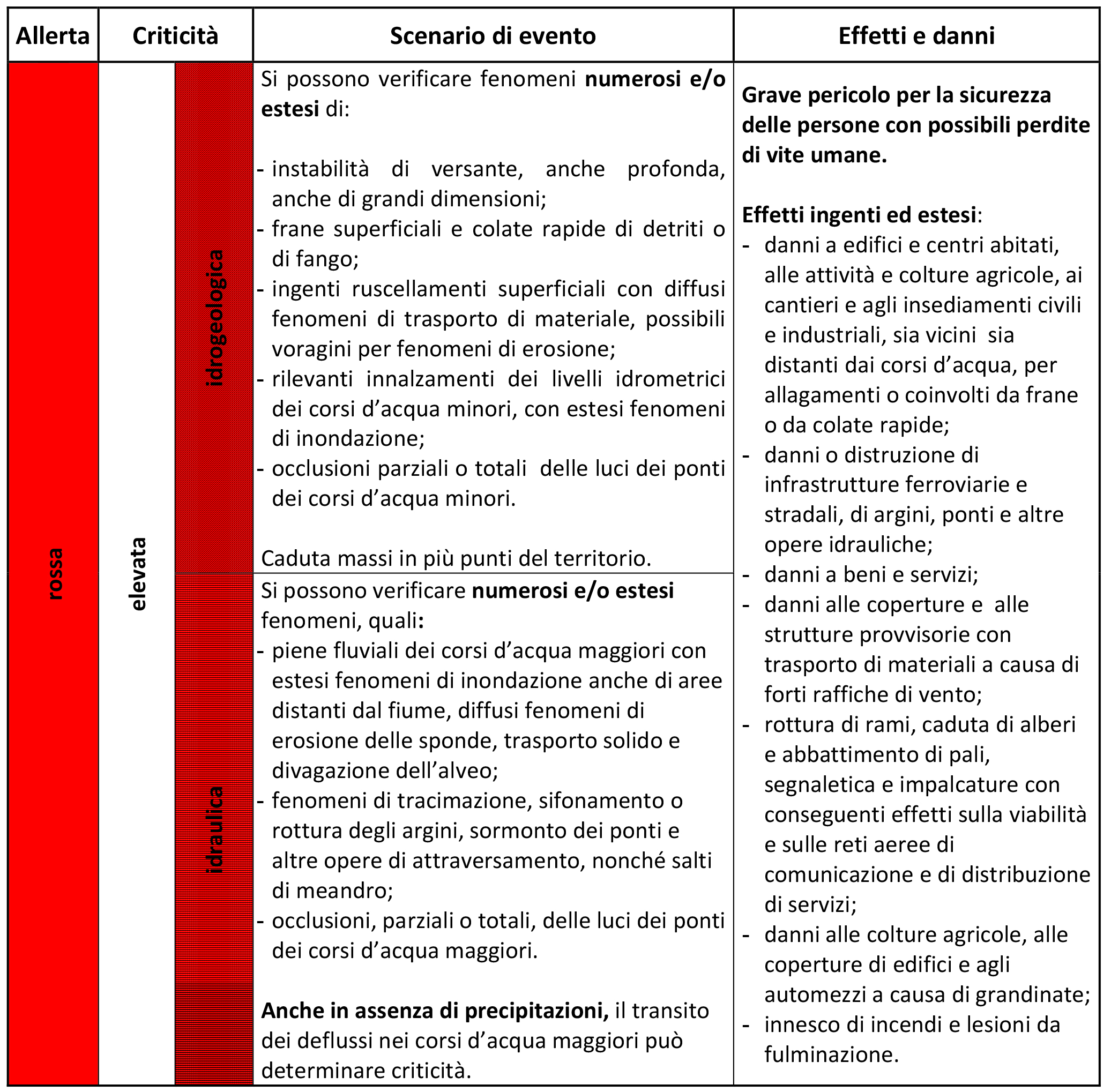
Table of hydrogeological and hydraulic weather alerts and criticalities
The table of meteo-hydrogeological and hydraulic alerts and criticalities is included in the first annex of the operational indications signed by the Head of the Department on February 10, 2016, "Methods and criteria for the homogenization of the messages of the national warning system for meteo-hydrogeological and hydraulic risk and the response of the civil protection system." The table outlines the expected event scenarios over the national territory and the potential associated damage and effects for each level of criticality/alert, grouped by type of risk (hydrogeological, hydraulic, and thunderstorm).
In detail, the highest level of alert expected for thunderstorm risk is orange, and the red alert is not expected because these phenomena are associated with intense and widespread severe weather conditions that already characterize the red criticality/alert scenario for hydrogeological risk. The effects and damages produced are also the same.
The table should be regarded as illustrative and not exhaustive of the phenomena that can occur. Further detailed information can be found in Annex 1 to the Operational indications.
The infographic "Infographic on meteo-hydro alert" was created to give a brief representation of the table as part of the discussion that the Department started with the Regions and Autonomous Provinces regarding the nationwide homogenization of operational tools and standards related to warning, planning, and emergency management activities.