The plan for vulnerability assessment of built-up areas affected by bradyseism in the Phlegraean Fields
Decree-Law No. 140 of October 12, 2023, introduced urgent measures to address the consequences of the evolving bradyseismic phenomenon in the Phlegraean area, within the territory of certain municipalities or parts of municipalities in the Metropolitan City of Naples, including simplified procedures and additional measures aimed at streamlining processes.
Specifically, for the Phlegraean Fields intervention area, Article 2 provides for an Extraordinary Plan to support seismic retrofitting efforts and to identify priorities for action regarding the building heritage. The plan was approved by decree of the Minister for Civil Protection and Maritime Policies on February 26, 2024.
The coordination of activities has been entrusted to the Civil Protection Department, and implementation is assigned to the Campania Region, the Metropolitan City of Naples, the municipalities of Bacoli, Naples, and Pozzuoli, and the Interregional Superintendency for Public Works, with the support of technical and scientific expertise provided by the Civil Protection Competence Centres.
In addition, by decree of the President of the Council of Ministers dated July 17, 2024, an Extraordinary Government Commissioner was appointed to oversee the seismic retrofitting of public buildings and to ensure the proper functioning of transportation infrastructure and other essential and priority public services.
The 2025 Budget Law, in line with the activities outlined in the Extraordinary Plan and based on the results of the simplified CARTIS analyses, has allocated funds for the implementation of measures to reduce the seismic vulnerability of private residential buildings, in accordance with the detailed provisions of the Decree issued by the Minister of Civil Protection and Maritime Policies on November 12, 2025. Specifically, 100 million euros (20 million euros for each year from 2025 to 2029) have been allocated for measures to reduce the vulnerability of private buildings in the target area. Under Decree-Law No. 144/2026, the state allowance was increased by 50% to 70% of the eligible costs to be incurred.
The Plan envisaged the following four activities.
The measure provides for a Level 3 seismic microzonation study, which represents the highest level of detail required by national standards for this type of study and is designed to quantitatively assess the local effects of seismic activity, with specific focus on particular issues or areas.
Implementation approach. The investigations provide the knowledge base for the development of the seismic microzonation study, which is essential for enhancing our understanding of the geology of the Phlegraean area and improving our comprehension of earthquake amplification effects and the instabilities triggered by seismic events (such as landslides and liquefaction).
The investigation campaign involved exploring the subsurface at shallow depths using minimally invasive techniques: the boreholes drilled had a small diameter (12 cm) and reached limited depths (approximately 30 m), so as not to disrupt residents’ daily activities. Further investigations, however, were confined to surface measurements.
The parties involved. The Extraordinary Plan assigned:
▪ to the Campania Region, responsibility for awarding contracts for geotechnical and geophysical surveys within the territory of the three municipalities included in the intervention area;
▪ to the municipalities, responsibility for commissioning qualified external professionals to prepare Level 3 seismic microzonation studies, based on a survey plan prepared by CNR-IGAG in collaboration with INGV;
▪ to the CNR-IGAG and INGV Competence Centres, responsibility for monitoring, coordinating, and verifying the quality of the studies, as well as conducting surveys and/or analyses of particular technical difficulty.
The sum of €1.5 million has been allocated for the implementation of the measure.
Implementation status
▪ April 2025: The particularly complex investigations carried out by CNR-IGAG and INGV were completed;
▪ September 2025: The company awarded the contract by the Campania Region began field investigations.
▪ March 2026: Geognostic investigations were completed;
▪ April 2026: Data processing from the investigations was completed;
▪ In progress: Transfer of information to experts appointed by the municipalities for completion of the studies.
The activities are scheduled to be completed by the end of 2026.
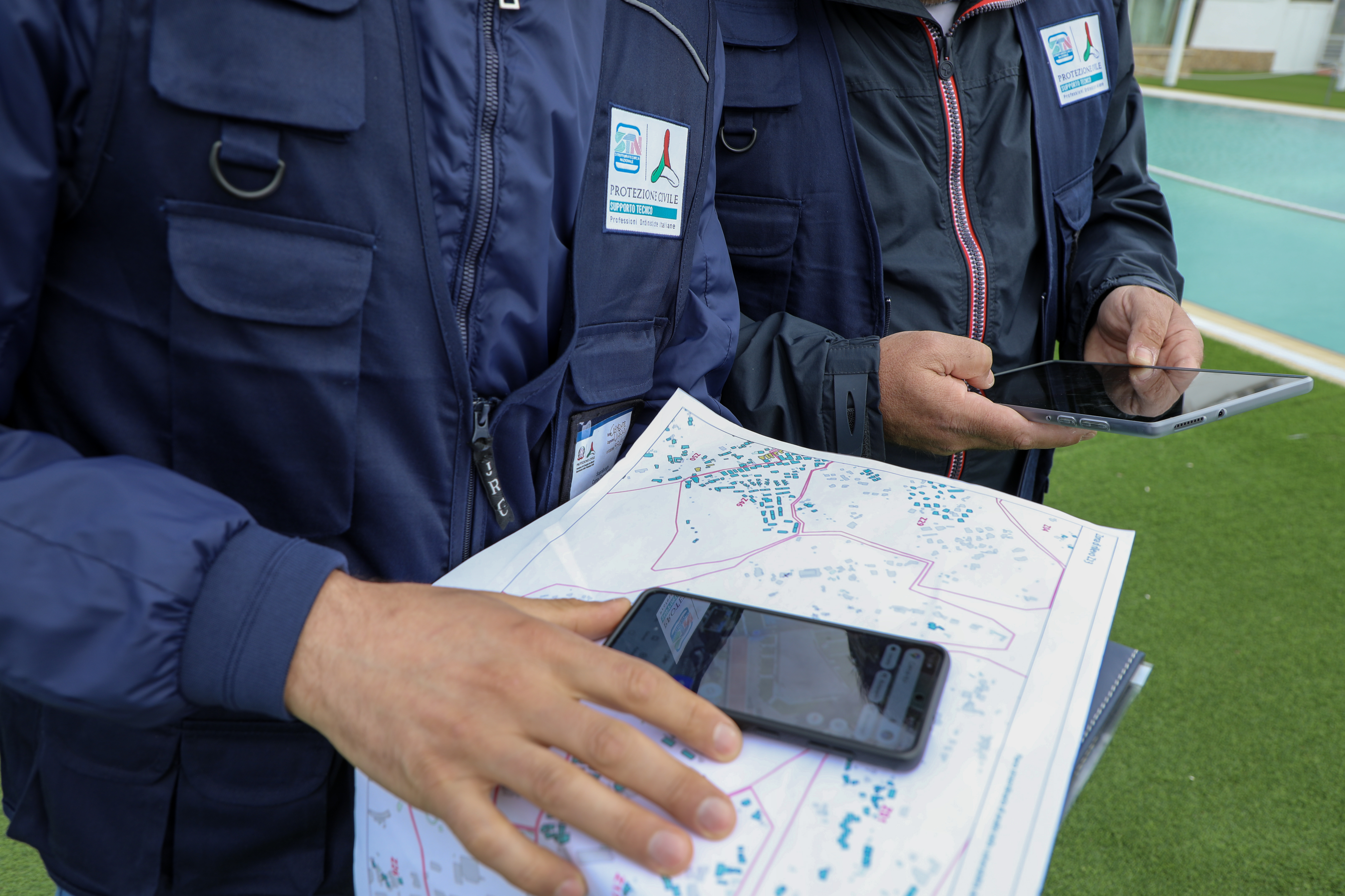
The Extraordinary Plan included several assessment and in-depth analysis phases, carried out through technical site inspections, aimed at evaluating the vulnerability of private buildings.
The Department’s Centres of Competence collaborated in these activities: the PLINIVS Research Centre for the first phase and the ReLUIS Consortium for the subsequent phases.
Implementation approach and parties involved. The initiative began with a preliminary, expedited survey using a form developed by the PLINIVS Research Centre, followed by a more detailed survey conducted using the “CARTIS-comparto” form developed by the ReLUIS Consortium.
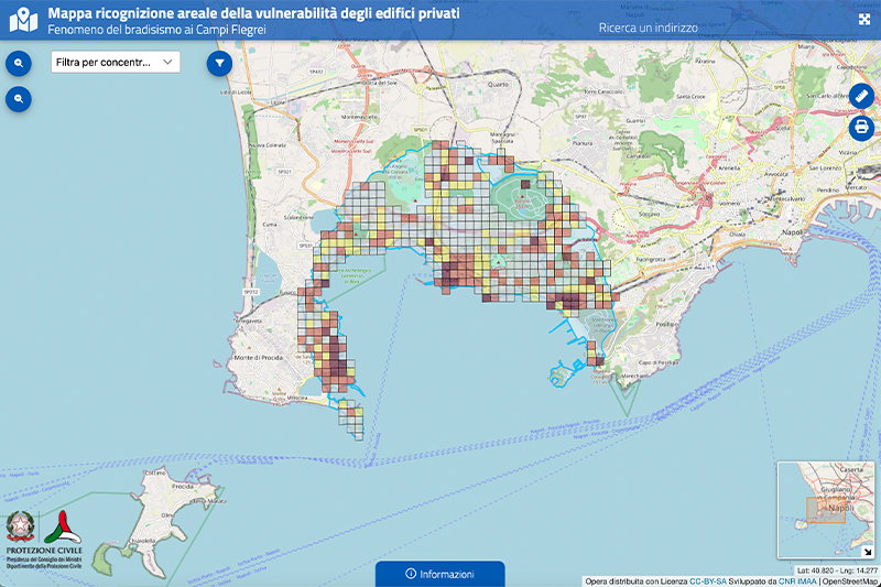
The data collected using the PLINIVS form, through technical inspections conducted outside the buildings, enabled the development of an areal vulnerability map of the intervention area, which served as the basis for planning subsequent in-depth inspections, including those conducted inside the buildings. The data and information collected during the area survey were organized into an interactive dashboard featuring graphs that illustrate the most representative characteristics of the private building heritage analyzed.
Subsequently, a detailed analysis of the characteristics of each individual building was conducted at the request of residents using the "CARTIS-edificio" form. Using the data collected, the ReLUIS Consortium assessed the vulnerability of each building through specific simplified procedures that do not constitute a formal seismic assessment within the meaning of the Technical Standards for Construction. The buildings were therefore classified into seven vulnerability categories ranging from A+ (very low vulnerability) to F (very high vulnerability). Upon completion of the assessment, the municipalities notified building owners of the results for each building.
The ReLUIS Consortium has also been tasked with conducting a quick survey of building facades, that is, the system of elements that make up the buildings' exteriors (e.g., plaster, cornices, and front panels), of buildings facing certain volcanic risk evacuation routes, as well as drafting a mitigation plan that quantifies the costs of the required interventions.
The measure has been allocated a total of €3.5 million in funding.
The vulnerability analysis based on data collected via the “CARTIS-edificio” form enabled property owners to access grants for seismic retrofitting projects made available by the 2025 Budget Law, in accordance with the implementation guidelines outlined in the Decree of the Minister for Civil Protection and Maritime Policies of November 12, 2025. Specifically, €100 million (€20 million for each of the years from 2025 to 2029) has been allocated for measures to reduce the vulnerability of private buildings in the project area.
Implementation status
▪ June 2024: On-site inspections using the PLINIVS form were completed for a total of 5,118 buildings;
▪ March 2025: The areal vulnerability map of the intervention area was published, and simultaneously the online platform was launched to allow citizens to submit requests for in-depth on-site inspections using the "CARTIS-edificio" form;
▪ September 2025: In-depth assessments using the “CARTIS-edificio” form were completed for the buildings covered by the requests;
▪ July–November 2025: The vulnerability analysis for the buildings subject to “CARTIS-edificio” inspections was completed (1,167 assessments processed by the ReLUIS Consortium), followed by notification of the results to the owners;
▪ December 2025: Results of the vulnerability analyses of building facades facing escape routes, covering a total of 12.4 km, were delivered to the municipalities;
▪ March 2026: The ReLUIS Consortium prepared the mitigation plan and cost estimates for interventions aimed at reducing seismic vulnerability of the buildings subject to in-depth analysis using the "CARTIS-edificio" form.
▪ Starting in January 2026, as established by Decree-Law No. 200 of December 31, 2025, “Urgent provisions on regulatory deadlines,” converted into Law No. 26/2026, the Department has been tasked with supporting municipalities in monitoring interventions carried out using grants for reducing seismic vulnerability.
The measure relating to the vulnerability of public buildings was designed to assess the vulnerability of the public building heritage in the Phlegraean area and to initiate an initial seismic risk mitigation plan.
The strategy included two main actions: conducting technical inspections in accordance with the guidelines outlined in the Technical Standards for Construction (NTC 2018), and implementing structural improvements to reduce vulnerability.
With the entry into force of Decree-Law No. 91/2024 (subsequently incorporated into Decree-Law No. 76/2024 and converted into Law No. 111 of August 8, 2024), responsibility for carrying out structural interventions was transferred to the Extraordinary Commissioner for Interventions in the Phlegraean area. Priority was assigned to strategic and significant buildings, with particular attention to schools and facilities housing minors.
Implementation approach. The activities were divided into four operational phases:
- Baseline definition: identification and cataloguing of public buildings located within the intervention area;
- Technical inspection program: execution of technical inspections by the competent authorities, in accordance with the NTC 2018 guidelines, for buildings that have not yet undergone such assessments;
- First intervention program: implementation of an initial set of structural interventions to reduce seismic vulnerability, including buildings that have already undergone technical inspections;
- Second intervention program: development and implementation of a subsequent program of interventions, to be launched following the results of the new technical inspections conducted by the relevant authorities.
Stakeholders involved. Coordination of the activities was entrusted to the Civil Protection Department, while implementation was carried out by the Campania Region, the Metropolitan City of Naples, the municipalities in the intervention area, and the Ministry of Infrastructure—Interregional Superintendency for Public Works in Campania, Molise, Puglia, and Basilicata. The Extraordinary Commissioner also supported this initiative, and the ReLUIS Consortium assisted with preliminary technical assessments.
A total of €40 million was allocated for the implementation of the measure, of which €35.93 million was transferred to the Extraordinary Commissioner’s special account for the execution of the interventions.
Implementation status
▪ April–June 2024: The relevant authorities completed the baseline assessment of public buildings, identifying a total of 227 buildings, of which 44% lacked a seismic assessment;
▪ July 2024: Approval of the first intervention program by the involved agencies and its submission to the Extraordinary Commissioner for implementation;
▪ May 2026: Submission to the Commissioner of an initial set of seismic assessments, carried out by the agencies using funds from the Decree-Law, to accelerate the planning of further interventions;
▪ Ongoing: Completion of additional technical assessments.
Seismic and structural monitoring is aimed at improving the understanding of local seismicity and its impact on both the ground and buildings.
The measure was divided into several phases aimed at acquiring detailed data through the expansion of ground-motion monitoring networks (the INGV Accelerometric Network and RAN—the National Accelerometric Network) and building structural monitoring systems (OSS—Seismic Observatory of Structures). Technical and scientific support for the implementation of this measure was entrusted to the INGV and the CNR-IGAG Competence Centres.
Implementation approach and parties involved. The implementation plan consisted of the following three steps:
- Upgrade of the INGV Accelerometric Network – Vesuvius Observatory (OV): the INGV network originally consisted of 28 permanent seismic stations distributed throughout the Phlegraean area and was expanded between 2024 and 2025 with the installation of five additional multiparametric stations;
- Upgrade of the National Accelerometric Network (RAN): managed by the Civil Protection Department, this network includes a total of 18 stations, six of which were installed in 2024;
- Expansion of the OSS (Seismic Observatory of Structures): managed by the Civil Protection Department, this system initially comprised 4 monitoring systems in the intervention area and was expanded with two additional stations installed in schools.
A total of €200,000 was allocated for the implementation of this measure.
Implementation status
▪ March 2024: Installation of six stations of the National Accelerometric Network (RAN) completed;
▪ October 2025: Installation of two additional OSS stations completed, bringing the total to six stations;
▪ October 2025: Installation of five additional multiparametric stations of the INGV-OV network completed.